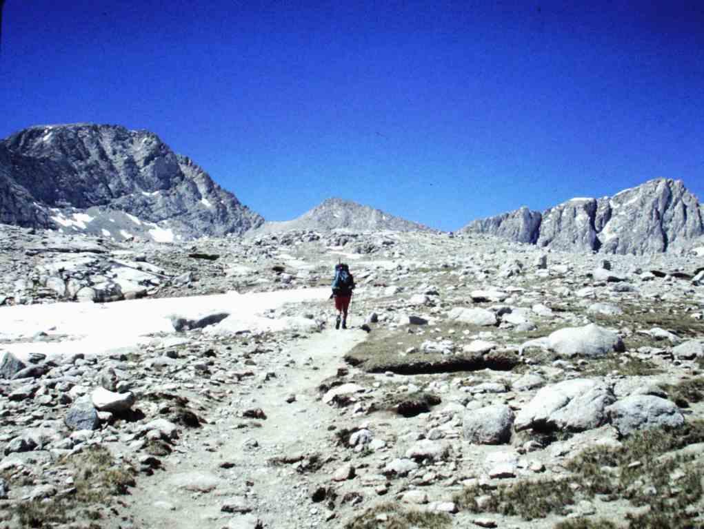
My eyes are searching in the wrong place for a trail. They are searching in the wrong place because I simply refuse to believe that the obvious route — up THERE and over THAT — is the route we will actually have to climb. Two days into a hike of the High Sierra Trail, my eyes are only just beginning to adjust to the scale: First, the giant trees of Sequoia National Park’s Giant grove, and now, this precipice that juts into the sky. But there is no way through that wall. The only way is over.
In Your Bucket Because…
- This hike offers a cross section of what makes the high Sierra so spectacular, from the giant sequoias on the western slope to the highest peaks in the 48 contiguous states.
- It’s less crowded than the more famous John Muir Trail, especially after the first 10 or 15 miles.
- Good for strong, enthusiastic hikers.
You know California’s High Sierra mountain range, of course: John Muir called it the “Range of Light;” Ansel Adams captured it in iconic photographs. You know that it has some of the biggest mountains, deepest gorges, grandest wilderness, and most remote terrain in the contiguous United States. But what this means when you are planing a hike, and what it means when you are looking at a wall of rock are as different as a walk in the park is from a climb up Mt. Everest.
The High Sierra Trail
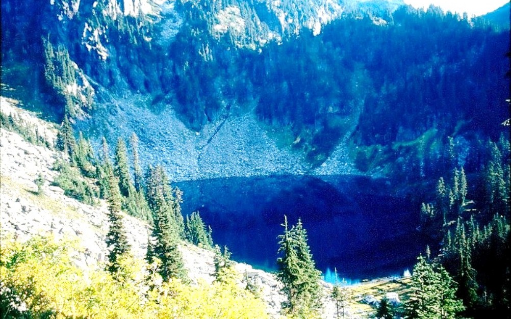
The High Sierra is the high heart of the Sierra Nevada mountain range, which runs south-to-north through much of the length of central and northern California. Starting from the western side of the High Sierra, the range gently tilts upward, reaching its highest points at the very eastern edge. On the eastern side, the mountains rise to elevations of 13,000 and 14,000 feet before plummeting into the dry lowlands of central California.

The High Sierra Trail starts amid the Giant Forest in Sequoia National Park, and crosses the range in an east-west direction, crossing the great Western Divide at Kaweah Pass, elevation 10,700 feet — the pass that had me staring unbelieving at the sky. It’s not nearly as crowded as the John Muir Trail, but it offers the same jaw-dropping (and leg-busting) mountains. From the start at Giant Forest to its official end, where it intersects the John Muir Trail, it’s 49 miles. The majority of hikers, though, do only a small part of it in a simple out and back, 11.6 miles to the designated backcountry campsite at Bearpaw Meadow (Note the name and be commensurately careful of food storage here: Black bears wander, sometimes brazenly, among the tents). There’s a also a small commercial “tent camp” (really cabin camp) here, which provides bedding and food; reservations required. Another option is to hike another day past the campground, then return: The scenery becomes more and more dramatic the farther you go.
If you do the entire hike, you’ll have to walk farther than the official length of 49 miles, because the trail ends precisely in the middle of nowhere, when it intersects the John Muir Trail. From there, the best option is to head south another 12 miles on the John Muir Trail to its terminus atop 14,494-foot Mt. Whitney. Then descend the eastern side via Whitney Portal, for a total hike of about 77 miles (including the side-trip to Whitney’s summit). Figure 7 days, depending on your fitness. You’ll have to arrange transportation back to the other side: A series of small airports in the eastern Sierra (at Bishop, Mammoth Lakes, and Inyokern) offers puddle-jumper flights.
Practicalities for the High Sierra Trail
- Seasonal challenges for hikers depend on month and elevation. Early season can be dangerous dangerous because of snow and river crossings (which are fed by snowmelt and can make even a normally small creek dangerous to cross). So even in the lower country, where trails may be clear of snow by May or June, the rivers will run high and fast.
- The high country (and this of course includes the climb over Mt. Whitney) may be snow-clogged well into July, depending on snowfall the previous winter.
- Another issue in the High Sierra is black bears, which can be persistent and aggressive about appropriating hikers’ food supplies, usually by trying to steal food at night. In the high country (above 10,000 feet), black bears are less of a problem in the early season. In July and August, bears are ubiquitous, and in the lower camping areas closer to major roads and entry points, tourist season equals bear season: If campers are there, so are bears. Always carry an approved bear-proof container for all food, and use any food storage lockers available at campsites.
- Wilderness permits are required.
Fact-checked 2020

I hiked the HST in early August 2012. It was wonderful! From Giant Forest to Whitney Portal it took me 4.5 days. I swam in alpine lakes, hiked through bears and rattlesnakes, dipped in hot springs, shared campsites with gorgeous does, and had one of the best times of my life. Long live the HST!