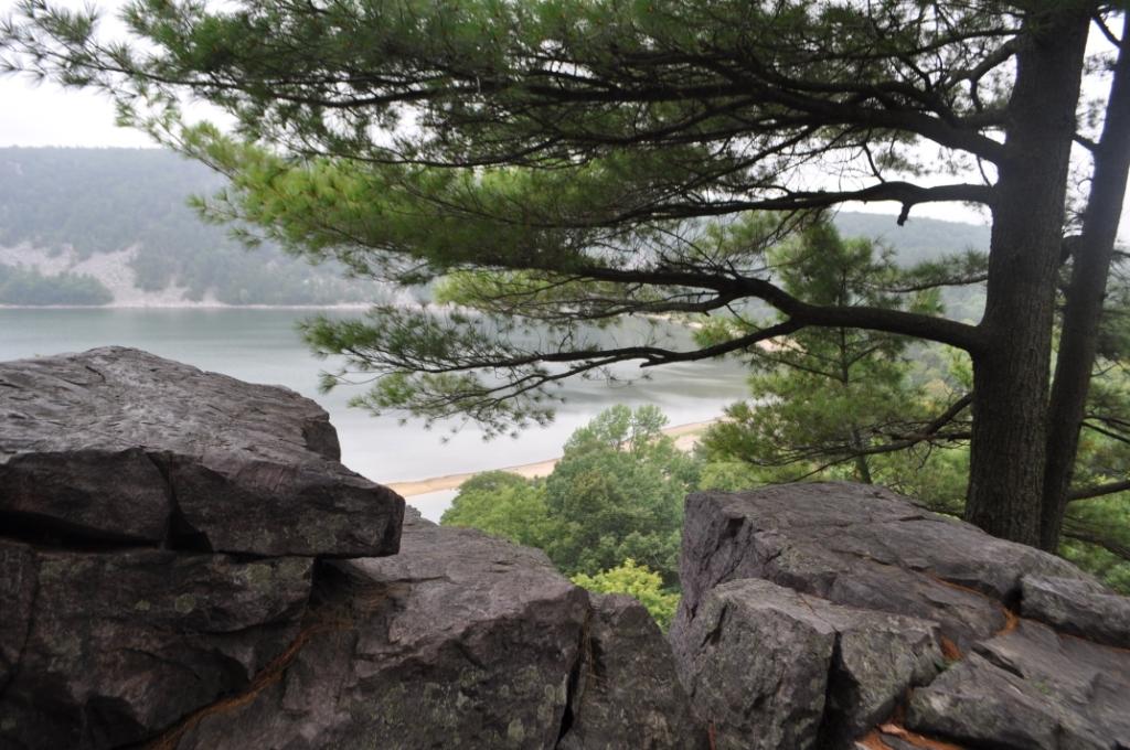
The difference could not be more stark than if I had flown to the moon. Less than a half an hour ago, I’d been dodging shrieking, laughing kids headed for waterpark fun in one of the many family-oriented resort-and-amusement parks of the Wisconsin Dells. Now, just three miles south of Baraboo, in south-central Wisconsin, I am gazing upon a cliff-fringed lake, the only sounds those of a few families scattered along the shore.
Devils Lake State Park could not be more different from the water parks and activity-jammed family hotels that make the Wisconsin Dells one of the upper Midwest’s most popular family destinations. Although the earliest tourists to the area came for the fishing, boating, and natural beauty of the Dells’s water-sculpted wonderland, today’s visitors are far more likely to be family travelers looking for something to entertain the kids.
But to my admittedly old-fashioned eyes, the real draw of the place is still its natural environment. Wisconsin Dells lies on the border between the part of Wisconsin that was sculpted by the advance and retreat of Ice Age Glaciers, and the so-called Driftless Area, which lay beyond the final advance of the glaciers. Its geological features include Wisconsin River’s dramatic cut through ancient sandstone bluffs, and Devil’s Lake, which was created when moraines of the glacier dammed a river channel between high bluffs.
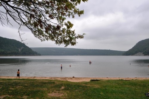
I must have gotten lucky: The lake is, in fact, one of the most popular parks in the entire state, so it’s not always this quiet. But on this particular late summer day, local kids have already gone back to school, and only a few families are quietly enjoying the beach and the picnic area. Perhaps everyone else is back at the water parks. “Poor them,” I think.
In Your Bucket Because….
- Wisconsin is filled with landscapes carved by the Ice Age. This is one of several destinations near or on the Ice Age Trail where thee is a visitor center that interprets the landscape so you know what you are looking at.
- Hikers will appreciate not only the trails around the lake, but the chance to walk on a section of the Ice Age Trail, which is one of only 11 national scenic trails in the United States.
- Good for nature lovers, families and those looking for peace and quiet (which you’ll appreciate if you’re staying in the main tourist area of the Dells!).
In the Path of the Ice Age

I’m here to check out the Ice Age National Scenic Trail, a 1,200-mile route that arcs and wiggles through Wisconsin. It is the only national scenic trail dedicated to a geological event, in this case the Wisconsin glaciation, and it doglegs in order to include this particular glacier-formed lake on its route. Trails on either side of the 360-acre lake wander atop the moraines to a series of rock formations that make scenic day-hike destinations.
I head out from the trailhead parking area, following an initially well-marked and well-worn trail up to the top of the moraines that surround the lake. It’s a steady climb, and as we move away from the trailhead, the way becomes less easy to follow, with interweaving and unmarked “social trails.” At one point it becomes clear that we’ve lost the trail we thought we were on. But no matter: We find our way to the top, where we take in views of the lake and the moraines that surround it. We see hardly any other hikers on the trail, and have the views to ourselves.
The Ice Age Trail: The Story of Water
The Ice Age Trail tells the story of water, ice, gravity, and time. Throughout the state, it leads hikers up and over ridges that were once tunnels that ran under the icesheet, or lakes carved by ice. Here at Devil’s Lake, the scenery was formed by moraines — piles of rock left behind as the glaciers melted and receded, and which finally formed a dam that created the lake.
Looking at the lake’s pretty, peaceful landscape, I find it hard to fit the huge numbers of the Ice Age into my brain: the cooling-and-warming cycles that took place over the last two million years, the mile-deep sheet of high that once covered much of the northern United States and all of Canada, the floods that ripped through the Wisconsin River to create the famed Dells, the force required to move hundreds of tons of rocks across landscape and pack them into piles — like these moraines — 500 feet feet high.
Today’s hiker might know little about glaciers or how they carve the land. but it is glaciers that put all those rocks underfoot, glaciers that created the lakes and the other strange features with their strange names: kettles and kames, eskers and drumlins. Unlike tectonic plates crashing and volcanoes erupting, glaciation can create a subtler sort of land remodeling. In the Midwest, much of the story is obscured by grass and leaves and farm crops — the perfectly ordinary things you can see everywhere in the largely gentle Midwest. But on the Ice Age Trail, and here at Devil’s Lake, the story is underfoot, and all around, if you take the time to look.
Practicalities
- Pick up hiking trail maps at the visitor’s center
- The lake also offers a swimming beach, boating, rock-climbing, accessible paved paths, and camping.
- Hiking boots or sturdy shoes are recommended: Glaciated terrain is rocky.
- Part of the park is operated by the National Park Service, and National Park Service Park passes are accepted here.